
Background
Earlham Cemetery (also called Earlham Road Cemetery and Norwich Cemetery) is the city of Norwich’s municipal cemetery, a lovely area of greenery to the west of Norwich’s city centre. The Cemetery dates from 1856 and was created as a result of an order issued by the Home Secretary to the Mayor of Norwich in April 1854 banning burials in Norwich churchyards.
The original Cemetery occupied 34 acres but has been extended since it was opened and now covers 85 acres. The newer pieces of land further out of the city have sparser tree cover and are more open. Many trees were planted when the Cemetery was established and there are some very fine specimens.
Friends of Earlham Cemetery are researching the history of Earlham Cemetery and have produced a brief guide as an Adobe Acrobat (PDF) file, entitled A Short History of Earlham Cemetery.
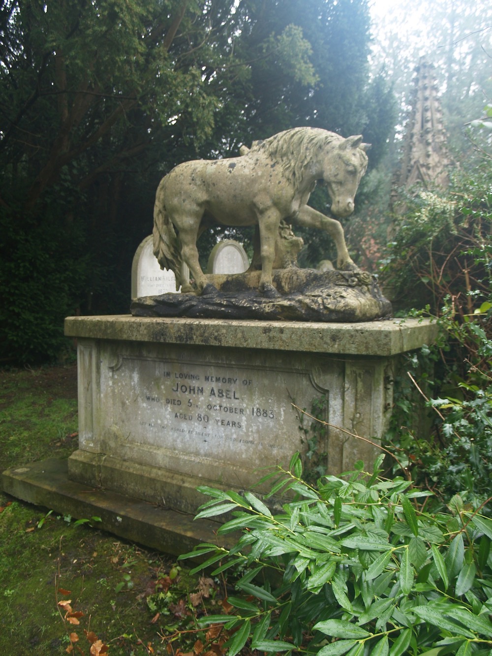
John Abel’s grave in Earlham Cemetery.
Books about Earlham Cemetery
Norwich Lives: selected graves from Earlham Cemetery by Françoise Donovan.
(NB: Now available on Amazon.)
John Abel: Horse-dealer of Norwich by Judith Havens.
The growth of Earlham Cemetery
Earlham Cemetery first opened in 1856.
Its original area was 34 acres (shaded in red and blue, superimposed on the 1881 Ordnance Survey Map).
23 acres were used for burial straightaway (shaded in red), while the remaining area (in blue) was let out as agricultural land until required.
The small red area next to Workhouse Lane (now Bowthorpe Road) is the Jewish Cemetery, which dates from the same time.
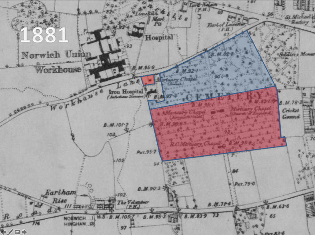
Figure 1 – The original size of Earlham Cemetery
Expansion
The map below (also superimposed on the 1881 Ordnance Survey Map) shows the subsequent expansion of the Cemetery.
In the mid 1860s the eastern half of the area shaded in blue was laid out as Sections 1 – 15 (NG). ‘NG’ stands for ‘New Ground’.
The western half of the area shaded in blue was laid out for burials in the late 1870s.
The Cemetery was extended in 1874 (in green), in the 1880s (in orange) and from 1892 onwards (in yellow). The site of Winter Road was a cricket ground until the 1890s.
Much of the land in yellow was used as allotments until it was needed for burial. Farrow Road was built around 1912 and the area of the Cemetery to the west of Farrow Road was used for burials from the 1940s onwards.
Earlham Cemetery now covers 85 acres.
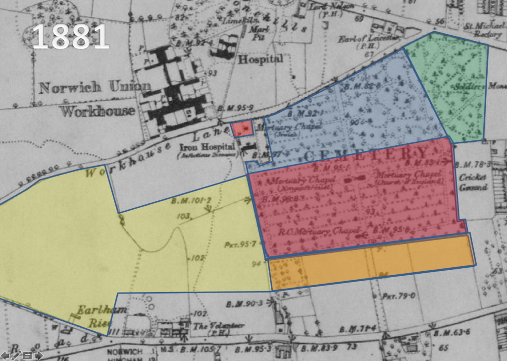
Figure 2 – The extent of Earlham Cemetery today